Photonic seismology - using telecom fibre optic cables to study earthquakes and images of the Earth's interior
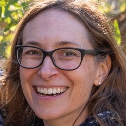
Through the recording and then analysis of seismic data, which can originate from earthquakes, ocean waves, or man-made sources, seismologists determine the structure of the Earth from the surface down to the core. Presented by Professor Meghan S. Miller.
Speakers
Event series
Content navigation
RegisterDescription
Watch the recording
Through the recording and then analysis of seismic data, which can originate from earthquakes, ocean waves, or man-made sources, seismologists determine the structure of the Earth from the surface down to the core. Seismic imaging is the best approach that can reveal deep Earth structure and processes that are both currently active (e.g. faults, earthquakes, volcanoes) and infer those that occurred billions of years ago (e.g. formation of the continents and mountain building). Using traditional techniques and seismic instrumentation, both in Australia and worldwide, seismologists have been able to detect changes in the Earth’s structure from effectively spot measurements and then interpolating the data between distant locations, which are often kilometres, if not 10s or 100s of kilometres apart. However, a newly developed technique, called distributed acoustic sensing (DAS), transforms existing telecommunication fibre-optic cables into thousands of individual of ground-motion sensors. I'll describe some amazing results of this technique from experiments in Melbourne and New Zealand that allow us to produce fine-scale "CAT-SAN" like images of the Earth’s subsurface, earthquake monitoring, and geo-hazard assessment.
About the speaker

My research focuses on observational seismology in order to understand the structural and dynamical evolution of the Earth. I combine the use of novel seismological techniques, including the collection of new data in regions where none are available, integrated with other, sometimes disparate, geologic and geophysical data, to solve outstanding questions in plate tectonics. Currently I have seismic deployments out in Alaska and Western Australia, but continue to work on data from previous experiments in Morocco, Spain, Timor Leste and Indonesia, along with other open access data such as USArray and those archived at AusPass and IRIS.
I am the Program Director for AuScope Earth Imaging and starting in 2022, I began my Australian Research Council (ARC) Future Fellowship working on the use of Distributed Acoustic Sensing (DAS) in seismic imaging.
I have moved back and forth between Australia and North America throughout my career, mostly between Los Angeles and Canberra.
Location
Online

